
Spatial information technologies have the potential to progress marine and coastal reporting now and into the future. It provides a new level of intelligence to help our marine and coasts.
This page presents spatial information technology and data coordination for state of the environment reporting, as outlined in Victoria's State of the Marine and Coastal Environment 2021 Report.
What is spatial information technology?
Spatial information technology refers to the use of technological inputs in collecting, managing, and analysing spatial data.
Spatial data, also known as geospatial data, is a term used to describe data related to a specific location on the Earth’s surface. Data alone tells us what, but spatially enabled data tells us where.

What spatial technology offers
Spatial technology helps us to understand our past, explore the present and plan for the future.
Spatially-enabled data and analysis bring location intelligence to decision-making, and provides the foundation for systems we rely on. Knowing where to act is important for the environment and building resilient communities.
It assists us to conceptualise, represent, and communicate complex data, offering a new level of intelligence for improving and understanding environmental outcomes.
In using spatial information technology, organisations can use digital data in combination with their own data for planning, management of assets, and operations.
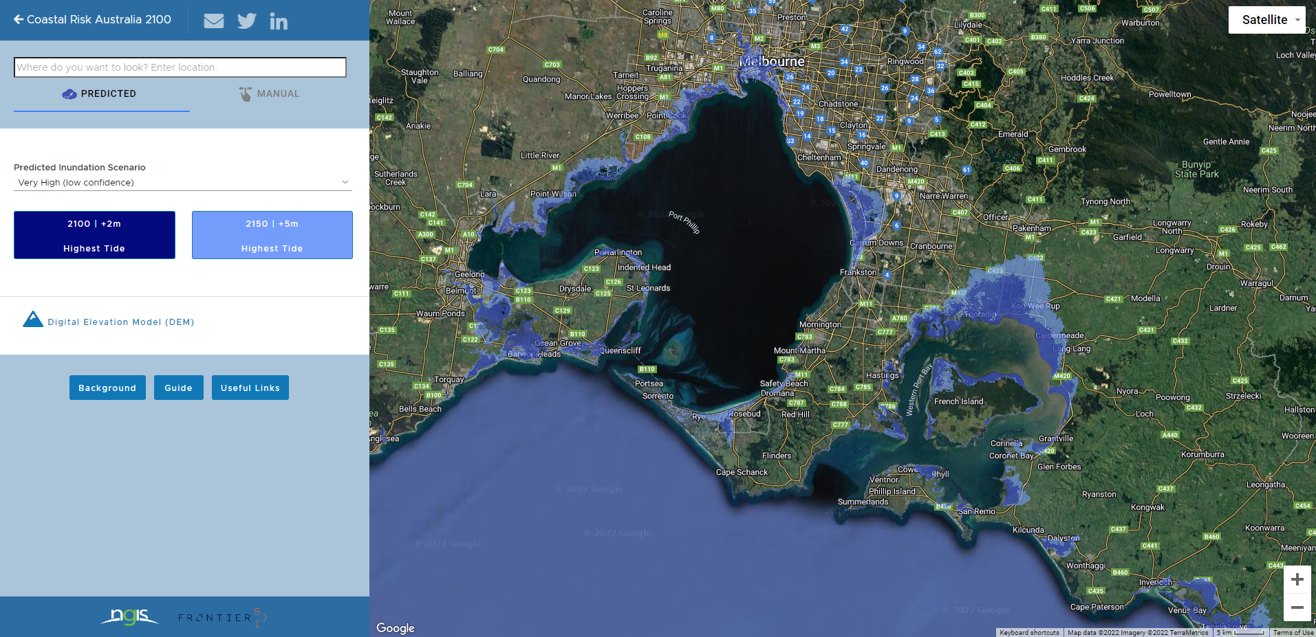
Spatial data provides valuable insights for environmental modelling of the marine and coastal environments. For example, combining aerial imagery and elevation data helps us chart our coastline to understand the potential impacts of climate change such as sea level rise.
Maps and spatial data help us manage and protect our environment, to safeguard the habitats of endangered species and other biodiversity.
Types of technology
A summary of spatial technologies, and the ways in which they can improve the quality of environmental reporting, are outlined below.
- Earth Observation and Remote Sensing
- Smart Sensors and the Internet of Things
- Remotely Piloted Vehicle Systems
- Global Positioning System and Tracking
- Citizen Science
- Artificial Intelligence and Machine Learning
- Big Data and Analytics (including Geographic Information System)
- Simulation and Modelling
Spatial data collection types and data technology maturity assessment table

This section focuses on spatial information technology and data coordination for state of the environment reporting.
Earth Observation and Remote Sensing
Earth observation (EO) involves capturing information about the Earth’s surface using remote sensing (RS). This technology began with capturing aerial photographs from a balloon just after the invention of photography. Today there are many different types of sensors, categorised as passive or active. Passive sensors do not emit radiation and typically use the sun as their energy source, whereas active sensors create their own energy source. There are different platforms for these sensors including drones, aeroplanes, satellites and ships.
Satellites have become smaller in recent years, which has led to reduced costs for their build and launch, in turn leading to the exponential growth of the number of satellites in space. There is a focus on getting better coverage, with the aim of providing close to real-time EO monitoring available to everyone.
Smart Sensors and the Internet of Things
The Internet of Things (IoT) is a network of organised physical objects or things with embedded sensors and software that can collect and share data over the internet. The physical objects can be items such as computing devices (e.g. phones), machines (e.g. vehicles), infrastructure (e.g. light poles) or even animals or people. IoT can help people live and work smarter by offering devices that can automate processes and access information from anywhere. Common types of sensors used in IoT include temperature, humidity, pressure, water level, proximity, infrared and optical sensors.
Remotely Piloted Vehicle Systems
Remotely Piloted Vehicles (RPVs) were originally used by the military for combat and surveillance. Aerial systems became popular as a recreational product in 2013 and, as technology advanced, the commercial use of drones began. The Civil Aviation Safety Authority (CASA) has rules and regulations for flying aerial RPVs. Consumers can use off the shelf RPVs (under 25kg) for sport and recreation if they follow safety rules.
Water-based RPVs like boats and submersibles can operate without a human occupant. Blimps, balloons and kites are becoming more common for continuous monitoring. Payload refers to the carrying capacity of the RPV and the equipment it carries. Sensor payloads include different types of cameras (optical, thermal etc.) or other specialised instruments such as particle sensors and magnetometers. Payloads can also be deliveries or collections such as water or soil samples. In the future, RPVs will become solar powered and self-driving.
Global Positioning System and Tracking
Global Positioning System (GPS) tracking is the system of monitoring the exact location of an object (e.g. car, person, animal, equipment) using GPS or broader Global Navigation Satellite System (GNSS) satellites and tracking devices. There are three main types of GPS trackers. Data loggers or passive trackers simply log the position of the device to their internal memory at regular intervals. This positional data then needs to be downloaded. Data pushers or active trackers are the most common type which push or send their location at regular intervals to a server. Data pullers or transponders are always on and can be queried to acquire the location data as often as required. The future of GPS and tracking will see ubiquitous, low-cost, high accuracy devices with improved battery life to enable multi-year lifespan tracking and contributing to the IoT and Internet of Animals.
Citizen Science
Citizen science is scientific research conducted by amateur or non-professional scientists with the aim to increase scientific knowledge. There are many types of citizen science projects including bird counts, frog watches, post bushfire animal monitoring projects and so on, for marine and terrestrial plants and animals. Citizen science has become popular globally over the past few decades and is becoming more common and technology enabled. There are now many citizen science platforms available for people to find projects and activities and contribute data (e.g. the Atlas of Living Australia and iNaturalistAU). The future of citizen science will be citizen sensing which will see people using low-cost or self-built sensors to collect data to find out more about issues they care about and empower themselves.
Artificial Intelligence and Machine Learning
Artificial Intelligence (AI) is a technique which enable machines, via computer programs, to mimic human behaviour. Machine Learning (ML) is a subset of AI which uses statistical methods within computer programs to enable machines to improve with experience and use of data. Although most of a ML process can be automated, considerable upfront investment is required to produce training data, train an algorithm, review the outputs and perform any manual corrections required. AI and ML are new and emerging fields along with deep learning which is a specific ML approach that makes the computation of multi-layer neural networks feasible. The future of AI and ML will see improvements in natural language processing. There will also be AI robotics, Artificial Internet of Things (AIoT) and AI and ML on board satellite platforms.
Big Data and Analytics (including Geographic Information System)
As big data comprises EO, RS and IoT data, and analytics includes AI and ML, there is significant overlap between this and earlier categories. Big data is defined by the three ‘V’s of volume, velocity and variety. So big data is larger, faster, and more complex from many different sources. Big data analytics uses advanced technology systems and mathematics on big data to uncover hidden patterns, correlations, and other insights. There are four types of big data analytics: descriptive, diagnostic, predictive and prescriptive. The development of open-source frameworks which enable a network of computers to solve problems, enabled the growth of big data by making it easier and cheaper to work with. The volume of big data is growing exponentially with the rise of IoT and ML and will increasingly be stored and processed in the cloud.
Simulation and Modelling
Spatial modelling is a process of spatial analysis that uses mathematical rules and procedures to analyse and visualise spatial data. While modelling is the act of building a model, simulation is the process of using the model to study the behaviour of a system. The objective of spatial modelling and simulation is to study objects or phenomena that occur in the real world for problem solving and planning. Models and simulations are an important way to study inaccessible systems, and to complement conventional approaches of scientific experiment and observation. The future of simulation and modelling may include an Ocean Avatar (whole of ocean digital twin) and real-time monitoring feeds within simulated environments.
Future Opportunities
- The opportunity in the for future to adopt more spatial technologies is evident and continues to increase. Prioritising these opportunities and developing an ongoing process for improvement will put Victoria in a leadership position and will provide a template for reporting that is efficient, effective, and informative.
- With emerging technologies, both the spatial resolution and temporal resolution of data will improve and, with this, data volumes will increase. Over time, the role of our reporting to synthesise this data into insights may become more technically complex, but the opportunity to create information that is better able to represent change over time, at more local scales is an exciting one. Many of the data collection types and technologies discussed above should not be used in isolation as they will produce more valuable impacts with integrated approaches.
Discover more
Victoria's State of the Marine and Coastal Environment 2021 Report
- Explore this interpretive website.
- View or download the Spatial chapter of the publication.
- Dive into the case studies exploring the report themes.
Explore spatial data in your area
- View Coastal Risk Australia's data mapping tool capabilities.