
Across Victoria there are 30 marine protected areas (MPAs). These regions legally protect Victoria's diverse marine plants and animals, and their habitats.
In partnership, Deakin University and Parks Victoria have been implementing a modernised marine monitoring program to measure the health of MPAs. The program provides information about natural values, ecological processes, threats and other drivers.
A mixture of new technology and traditional approaches enable monitoring at depths and scales that have previously been challenging:
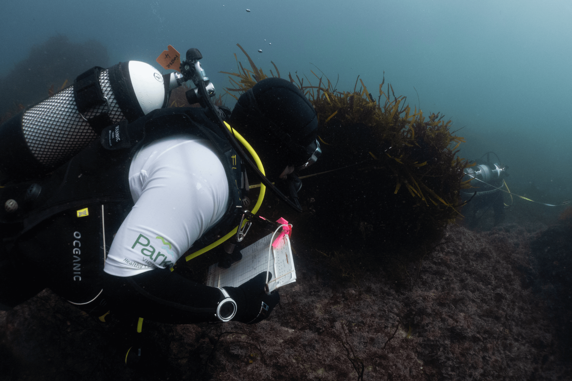
- In underwater visual censuses, scuba-divers record the identity and abundance of species along underwater transects.
- Baited remote underwater videos (BRUV’s) are stationary video cameras on the seafloor. They record species attracted to bait attached to an extended arm.
- Underwater imagery can be captured from a camera system recording the seafloor as it is towed above the ocean bottom behind a vessel. It can also be attached to an underwater robot programmed to travel independently.
- Unmanned aerial vehicles can also capture imagery. Unmanned aircrafts are programmed to travel independently and allows for sampling of large areas.
- Habitat mapping and species distribution modelling uses detailed mapping of the seafloor from sonar, underwater imagery, species abundance data and measurements of environmental conditions. It predicts the distribution of habitats or species based on their environmental relationships
- A fishery independent survey observes species in the absence of any fishing activity. It uses consistent experimental design and methods to assess abundance.
These approaches are complementary and provide information about different aspects of marine parks. For example, species which are difficult to find using other methods can be detected using underwater visual censuses. BRUV’s and fishery-independent survey’s allow comparison of species inside and outside of MPA’s and at greater depths than divers are able to survey. This helps shine a light on the benefits of MPA protection.
Underwater imagery, habitat mapping and species distribution modelling provides information about the distribution of habitat and species across whole park areas. This can be used to identify hotspots and areas to prioritise management.
The indicators adopted in this program tell us about the key ecological attributes (KEAs) or threats to MPAs. KEAs are aspects of an MPA’s biology or ecology that, if present, defines a healthy condition. If they are missing or altered, outright loss or extreme degradation of MPA condition can occur. Examples of indicators include:
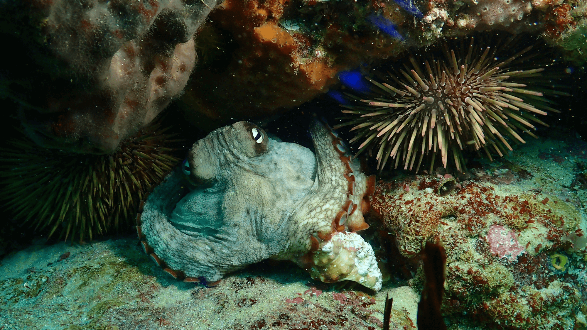
- The coverage of brown macroalgae (kelp/seaweed) dominated beds, which are a critical habitat for the shallower parts of reefs (forests of the sea) and are vulnerable to climate change and overabundant native urchin grazing.
- The abundance and size of large mobile fish (including sharks and rays) especially those that are ‘site attached’, which are often dependent on healthy reefs and can be targeted by fishing.
- The abundance and size of mobile macroinvertebrates including southern rock lobster and abalone. These are keystone species, for which illegal fishing has been identified as a major threat.
The new monitoring program is being implemented in the following Marine National Parks:
- Discovery Bay Marine National Park
- Point Addis Marine National Park
- Port Phillip Heads Marine National Park
- Bunarong Marine National Park
- Wilsons Promontory Marine National Park
- Cape Howe Marine National Park.
So far, these programs have provided important and useful information to Parks Victoria, including:
- the health of fish populations in MPAs
- The status of key habitat forming kelp species
- impacts from overabundant urchin grazing, climate change and possible illegal take of species within MPAs.
You can read about the health of Victoria's MPAs in the State of the Marine and Coastal Environment 2021 Report.