
Did you know that beaches are dynamic systems which change and evolve as waves break on the shore?
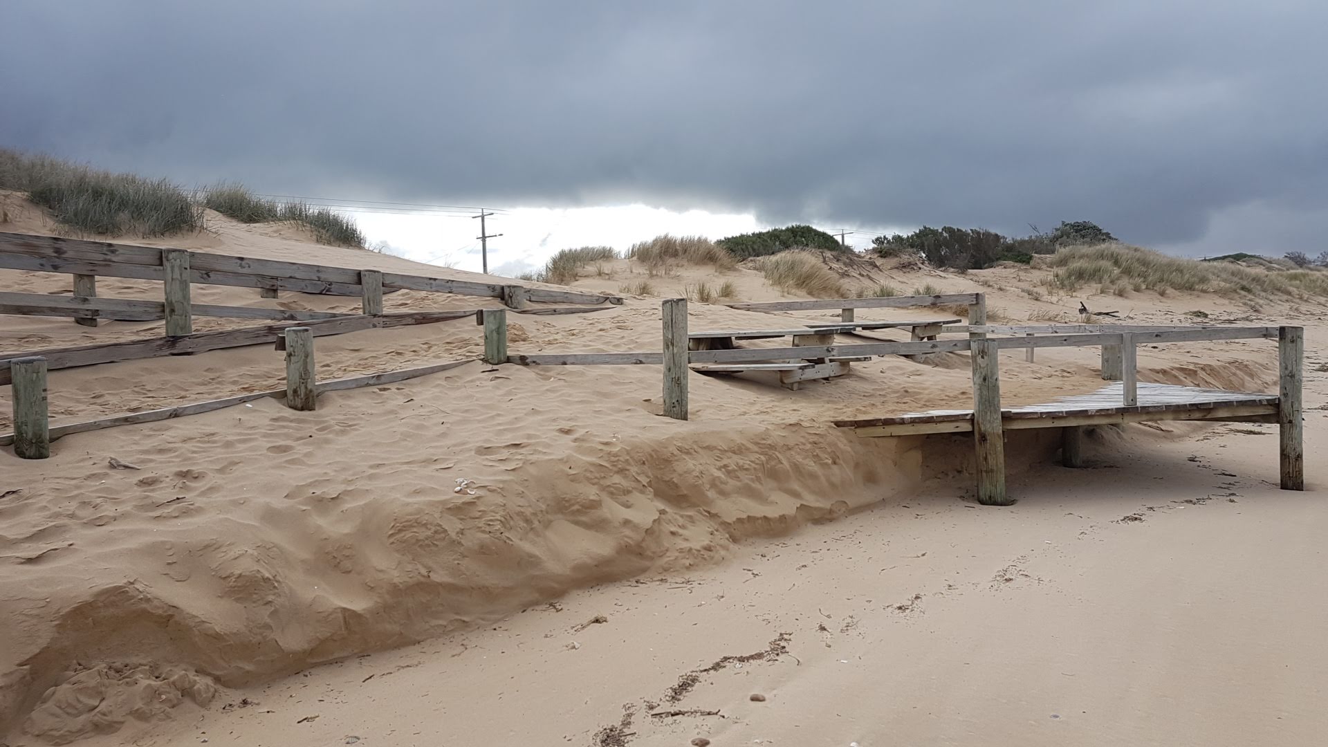
Erosion on a beach happens when sand moves from one area to another. It is a natural process and but can cause issues, especially when humans put infrastructure in the active beach zone which includes coastal dunes. The sand moves to another area to balance the energy that impacts the coast.
Beaches are also natural buffers to storms, guarding the land from inundation by the sea.
They are also tied closely to benthic communities in the sea as many of our beaches have high carbonate content form the breakdown of animals and shells with calcium carbonate. A changing climate and in particular ocean acidification may cause issues with sediment production and supply.
It is difficult for coastal managers to predict the impact of storms on beaches at scale. Finding out whether sand will naturally return after an erosion event or how climate change may impact a specific beach can be challenging. Likewise, traditional methods for measuring beaches can be time consuming and expensive.
Increasing population at the coast, coupled with climate change, will put humans at greater risk of coastal hazards. Rising sea levels and a changing wave climate are likely to cause erosion of many Australian coastlines to speed up. This will affect coastal infrastructure, ecosystems and communities.
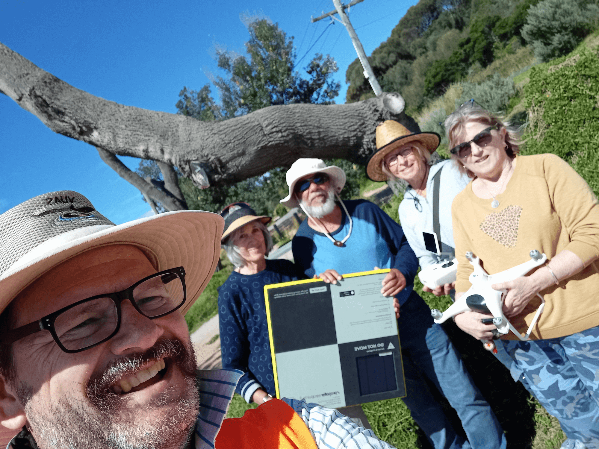
The Victorian Coastal Monitoring Program’s citizen-science drones is a world first initiative. The program empowers community to actively monitor and project beach change.
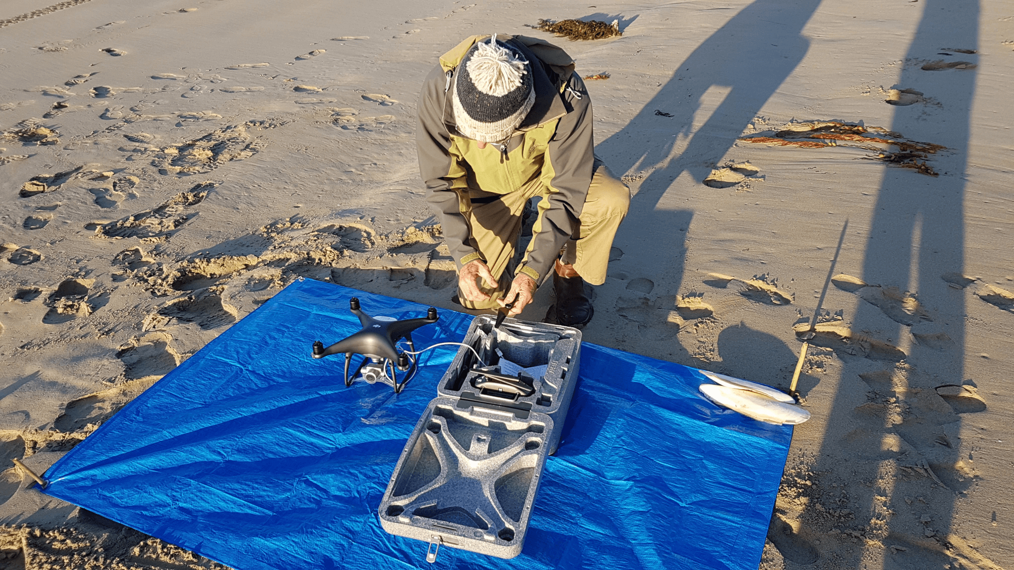
The program uses consumer-drone technology and cloud data processing. It enables citizen-scientists to collect, process and analyse sand movement on Victoria’s beaches. The result is three-dimensional surface models and aerial photography of centimetre-scale precision and accuracy. This enables measurement and monitoring of everything from footprints to dune erosion scraps. All data is open source, enabling community members to observe statewide beach change.

This program is made possible through the latest advances in analysis of aerial photography, lightweight drone technology, cloud data processing and smart ground control. Once drone data is collected it is uploaded and analysed in the cloud. It is delivered to the community via the Australian-developed Propeller Aero Online Portal. The citizen scientists are therefore also trained in data analytics and management.
Citizen scientists are the core of the project. They look after the hardware, prepare and plan surveys, execute surveys independently, conduct crowd control during flights, and finally upload all the data to the Propeller Aero Online Portal. Without the enthusiasm and commitment of citizen scientists, this project would simply not exist. The project's citizen scientists are passionate about their ownership of the program and sharing knowledge to help protect their ecosystems and communities.
The project’s primary objective is to provide high quality citizen-science engagement and training to acquire precise and accurate survey data on beach dynamics for managers and researchers. Since 2018, the program has established 16 groups, engaged over 200 community members, undertaken over 1,300 flights, and collected over 400 datasets across 21 key coastal sites.
Read more about erosion and citizen science projects throughout Victoria in the State of the Marine and Coastal Environment 2021 Report.