Week 6: Information series for the State of the Marine and Coastal Environment 2021 Report
The Commissioner for Environmental Sustainability is exploring the themes from Victoria’s State of the Marine and Coastal Environment 2021 Report, over nine weeks.
This week, we take a closer look at the report’s coastal hazards theme.
The report shines a light on the health of our marine and coastal environments to inform investment in marine and coastal science. It reinforces the need for a catchment to reefs approach to our policy and program interventions to protect and improve Victoria’s coastal and marine environments.
Dr Gillian Sparkes AM, said “Our report examines risks such as coastal hazards, and how we can improve resilience in the face of change”.
Coastal hazard risks arise when marine and coastal processes have the potential to negatively affect environmental, social, cultural or economic values.
Dr Sparkes said, “Climate change is projected to increase certain types of hazard risks to the marine and coastal environment. Our report examines these risks and how we can improve resilience in the face of change.”
Coordinated planning that considers climate risks can mitigate current and future impacts on communities. This includes land-use planning that considers the impacts of sea-level rise, including more frequent inundation and erosion.
The Department of Environment, Land, Water and Planning (DELWP) analysed the extent and quality of Victorian councils’ consideration of climate change in land-use planning. Coastal councils were three times more likely than inland councils to have an intermediate, high or advanced consideration of climate change.
DELWP is leading implementation of Victoria’s first Marine Spatial Planning Framework. Marine spatial planning helps marine industry, government, and the community better plan activities in the marine environment and supports sustainable growth of Victoria’s blue economy and climate change adaptation planning.
All Victorian catchment management authorities (CMAs) are implementing climate change adaptation plans or strategies based on CSIRO’s latest climate change projections.
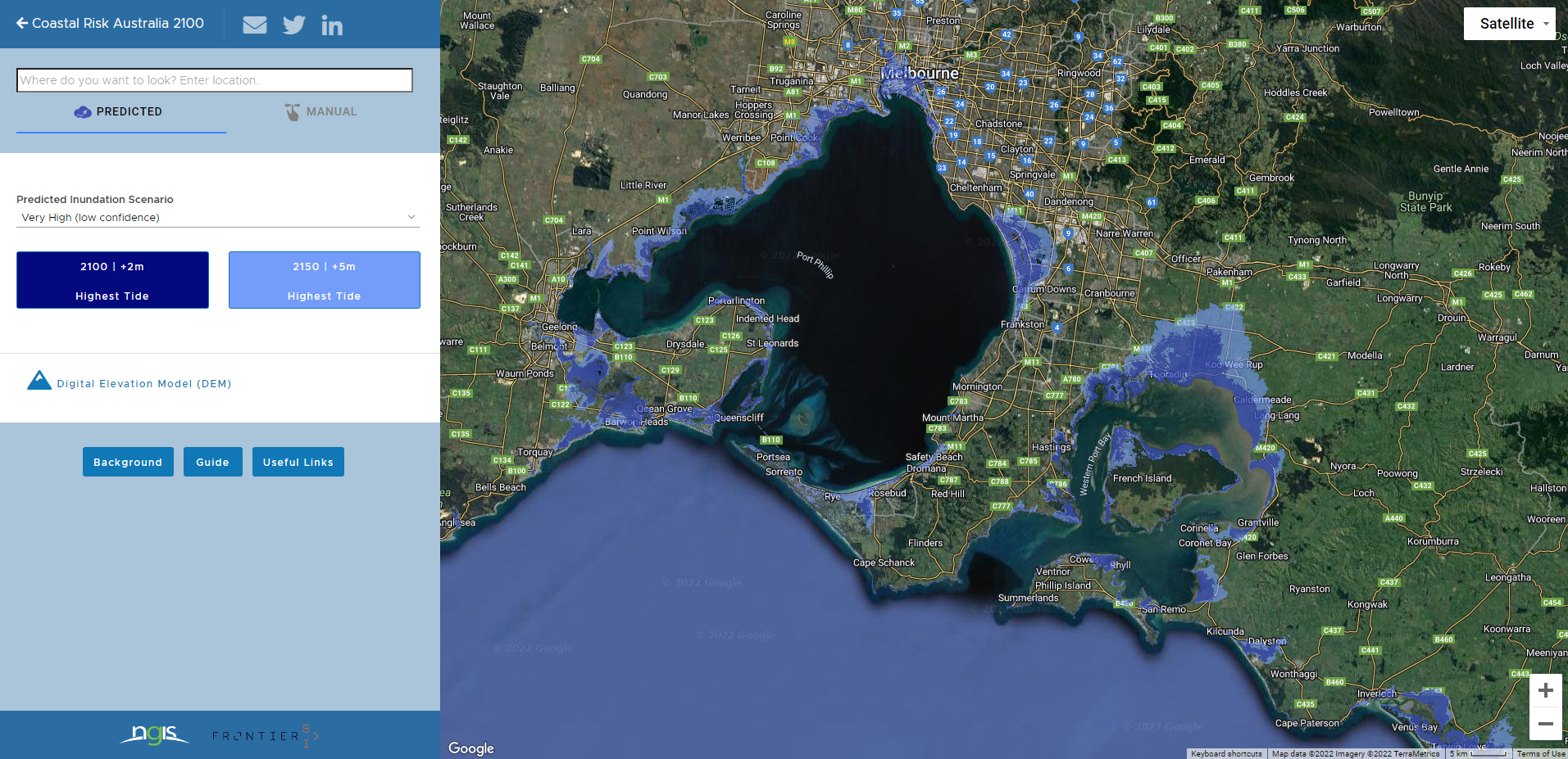
Spatial data provides organisations and the community with valuable insights for environmental modelling of the marine and coastal environments including coastal hazards. For example, combining aerial imagery and elevation data helps us chart our coastline to understand the potential impacts of climate change such as sea level rise. View our spatial analysis web page and explore spatial data on coasts and sea level rise using Coastal Risk Australia's data mapping tool capabilities.
Read more about coastal hazards in the State of the Marine and Coastal Environment 2021 Report and view the interpretive website.
Explore the science and predictions
- View the indicator assessments and key findings from the State of the Marine and Coastal Environment 2021 Report, see our coastal hazards page.
- Explore spatial data on coasts and sea-level rise using Coastal Risk Australia data mapping tool capabilities, developed by NGIS and Frontier SI.
Next week’s theme is climate change. Keep following the information series to learn more.
More information
- View the coastal hazards web page, including indicator assessments
- Explore case studies
- Explore the report’s interpretive website
- Download the State of the Marine and Coastal Environment 2021 Report and collateral
- Learn about Victoria's Marine Spatial Planning Framework
- Explore NGIS and Frontier SI's Coastal Risk Australia data mapping tool capabilities.